
Contact for Pricing

Cyvl.ai

AI infrastructure intelligence platform that turns vehicle-mounted 3D scans into road and sidewalk condition data for cities.

3.9 Data and Analytics
3.9 Good 3.9

Bottom line: Cyvl.ai is a capable data and analytics tool, best known for vehicle-mounted LiDAR and 360-degree imaging for infrastructure scanning.

Automates a task (manual road inspection) that is slow and inconsistent by hand No published pricing makes early budget comparison hard for smaller municipalities
Reviewed by Challenging Voice Editorial · Updated Jul 2026 How we rate
PricingContact for Pricing
Free planNo
CompanyCyvl
PlatformsWeb
Best forData and Analytics
Founded2020
Visits3
Last reviewedJul 2026
UpdatedJul 2026
Ask AI about Cyvl.ai ChatGPT Claude Perplexity

Overview

Cyvl was founded in 2020 and is headquartered in Somerville, Massachusetts, building AI tools that help civil engineers and municipal agencies inspect and manage physical infrastructure. The company has raised a total of $23.74 million, including a $14 million round that closed in October 2025 led by Sentinel Global.

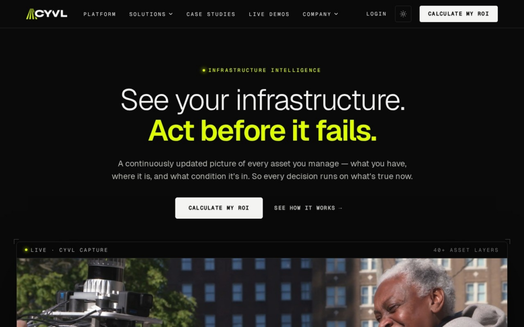
Vehicles fitted with Cyvl's LiDAR and 360-degree imaging sensors drive assigned routes, capturing 3D scans that AI models then process into automated condition assessments of pavement, sidewalks, and other infrastructure assets, replacing manual visual inspections. Cities can map their entire road network annually, or scale coverage up or down year to year, while keeping the same data format for tracking changes over time.

Built for municipal governments, departments of transportation, and civil engineering firms responsible for maintaining road and sidewalk networks rather than individual consumers. Cyvl prices contracts around annual network coverage rather than publishing a flat rate, so prospective customers need to request a quote based on network size and scan frequency.

Key features

  • Vehicle-mounted LiDAR and 360-degree imaging for infrastructure scanning
  • Automated pavement and sidewalk condition assessment from 3D data
  • Annual full-network mapping with adjustable coverage scope
  • Consistent data format for year-over-year infrastructure tracking
  • Built for municipal and civil-engineering procurement processes
  • Reduces reliance on manual visual road inspections

Screenshots & demo

Demo video

Screenshots

Cyvl.ai screenshot 1

Pricing

Cyvl.ai uses custom pricing. Contact their team for a quote based on your needs.

  • Pricing modelContact for Pricing
  • Starting priceCustom
  • Free planNo
Visit Cyvl.ai

Pricing is provided as a guide. Check the official site for the latest plans.

Pros & cons

Pros

  • Automates a task (manual road inspection) that is slow and inconsistent by hand
  • Predictable annual pricing structure once a contract is scoped
  • Funded to $23.74M with a recent 2025 raise, suggesting runway for growth
  • Consistent scan data format supports longitudinal infrastructure tracking

Cons

  • No published pricing makes early budget comparison hard for smaller municipalities
  • Sales cycle likely runs through government procurement, which moves slower than standard SaaS
  • Value depends on vehicle fleet coverage and scan frequency a city can commit to
  • Niche GovTech focus limits it to municipal and engineering buyers, not general businesses

How it compares

ToolRatingFreeFromBest known for
Cyvl.ai (this tool)3.9NoVehicle-mounted LiDAR and 360-degree imaging for infrastructure scanning
Powerdrill4.1YesFreePersistent agent memory that improves across sessions
Pecan AI4.3No$760/moSQL-based predictive modeling for marketing and growth teams
Vizly4.1YesFreeChoice of Python or R code generation

Our verdict

3.9 / 5 3.9

Cyvl.ai is a solid data and analytics tool, best known for vehicle-mounted LiDAR and 360-degree imaging for infrastructure scanning.

What makes it different: Cyvl.ai stands out for vehicle-mounted LiDAR and 360-degree imaging for infrastructure scanning.

How we score it
Overall 3.9
Value for money 4.2
Feature depth 4.9
Popularity 3.7
Best for ProfessionalsTeamsCreatorsCurious learners

Frequently asked questions

What is Cyvl.ai?
Cyvl.ai is a data and analytics tool listed in the Challenging Voice directory. AI infrastructure intelligence platform that turns vehicle-mounted 3D scans into road and sidewalk condition data for cities.
Is Cyvl.ai free?
Cyvl.ai does not offer a free plan.
What are the best Cyvl.ai alternatives?
Popular alternatives to Cyvl.ai include Causa, Arcwise, and Atlas. Browse them all in the Data and Analytics category.
Is Cyvl.ai any good?
Cyvl.ai scores 3.9 out of 5 based on our editorial review.

Reviews

3.9 No reviews yet

Write a review

Similar tools you might like